West Midlands Region
December 3, 2024
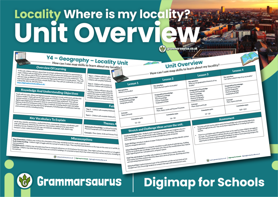
A useful editable unit overview to accompany our Year 4 Localities Unit. The file contains the following resources: – previous […]
June 7, 2024
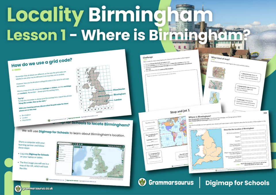
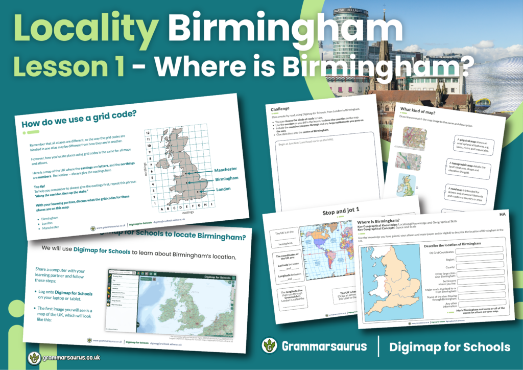
This differentiated geography lesson focuses on locating Birmingham using geographical skills. The file contains the following resources: - an […]
June 7, 2024
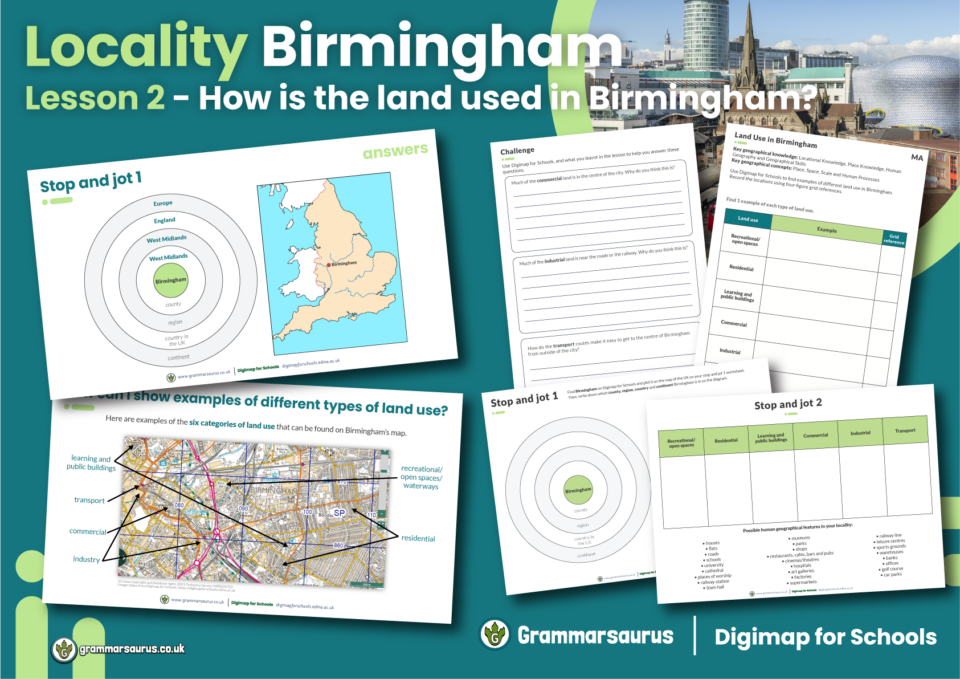
This differentiated geography lesson focuses on different types of land use in Birmingham. The file contains the following resources: […]
June 7, 2024

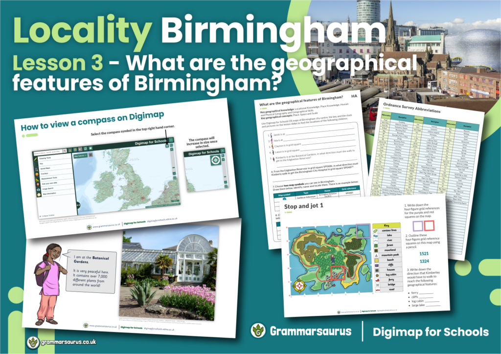
This differentiated geography lesson focuses on identifying and locating geographical features in Birmingham using digital maps. The file contains […]
June 7, 2024

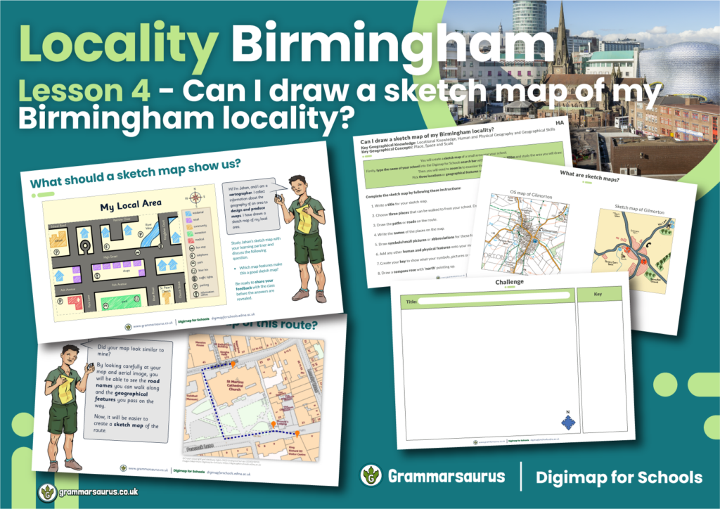
This differentiated geography lesson focuses on creating sketch maps to represent a locality of Birmingham, including human and physical features […]
June 7, 2024

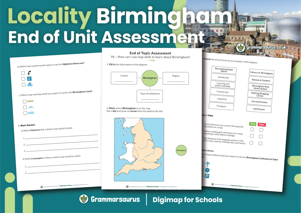
This end-of-unit assessment is a summative assessment tool to check for pupil understanding at the end of the Locality Unit. […]
June 7, 2024
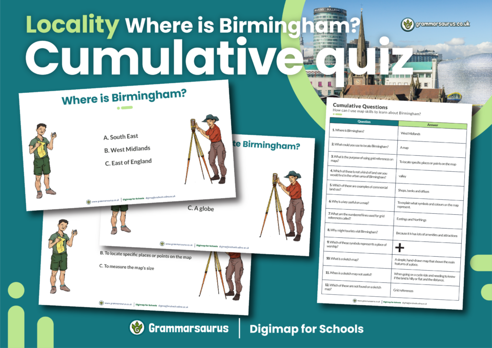
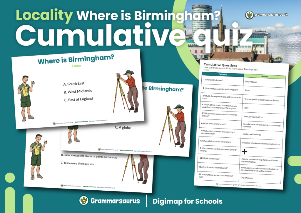
A useful editable cumulative quiz to accompany our Year 4 Geography Locality Unit.... Hello, Downloads are for members of […]
June 7, 2024

This differentiated geography lesson focuses on locating Brownhills using geographical skills. The file contains the following resources: - an […]
June 7, 2024

This differentiated geography lesson focuses on different types of land use in Brownhills. The file contains the following resources: […]
June 7, 2024

This differentiated geography lesson focuses on identifying and locating geographical features in Brownhills using digital maps. The file contains […]
June 7, 2024

This differentiated geography lesson focuses on creating sketch maps to represent a locality of Brownhills, including human and physical features […]
June 7, 2024

A useful editable cumulative quiz to accompany our Year 4 Geography Locality Unit.... Hello, Downloads are for members of […]